PRESS RELEASE March 09, 2021
Digital precision with new app
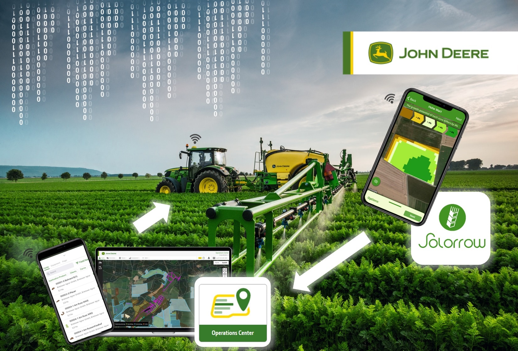
With a new site-specific app developed by the German start-up company Solorrow, farmers can easily create variable rate application maps for fertilising and other field operations and share them with the John Deere Operations Center.
From there, maps can be sent wirelessly to machines in the field to enable more precise applications, so that fertilisers and crop protection chemicals can be used more effectively and the environment protected in a sustainable way.
Software and app developments are becoming increasingly important in precision farming. Solorrow offers an affordable and very easy solution, which allows users to quickly identify fields and their boundaries in a map view on their tablet or smartphone.
Based on five years of biomass data, the selected areas can then be divided into different soil zones that act as the basis for fertiliser and spray application maps. These maps can be sent from the app to the John Deere Operations Center and then also sent wirelessly to the appropriate vehicle. The John Deere in-cab display receives the data and then gives the ISOBUS controlled fertiliser spreader or sprayer the site-specific application rate based on its current position in the field.
This interaction between the Solorrow app and John Deere’s Precision Ag technology solutions not only has agricultural benefits. The collaboration also demonstrates that a smooth exchange of data between different manufacturers’ software solutions is both possible and practical. In this way farmers always maintain full control over their data flow and data ownership.
With this new app, Solorrow and John Deere are combining their marketing and sales activities. This allows John Deere dealers to offer farmers and contractors an even wider range of Precision Ag systems, and customers can continue to benefit from the usual services for consultation, commissioning and technical support.